 handbasket")
|
Helena Observatory, Tupperville, NS |
|
|
| ||
Weather | ||
| 10-Jul-2026 17:39 ADT | 10-Jul-2026 20:39 UTC | |
|
| ||
|
|
Helena Observatory, Tupperville, NS |
|
|
| ||
Weather | ||
| 10-Jul-2026 17:39 ADT | 10-Jul-2026 20:39 UTC | |
|
| ||
Contents
|
Current Conditions
|
Links
|
Bridgetown Forecast
|
Marine
| |||||||||||||||||||||||||||||||||||||||||||||||||||
Today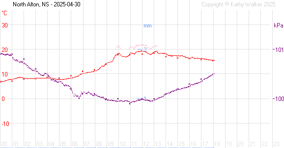 red - temperature pink - humidex light blue - wind chill purple - pressure blue - rainfall circles - Greenwood data |
Yesterday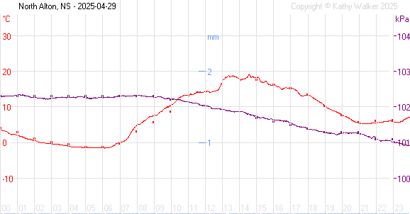 red - temperature pink - humidex light blue - wind chill purple - pressure blue - rainfall circles - Greenwood data |
Year to date
More Graphs |
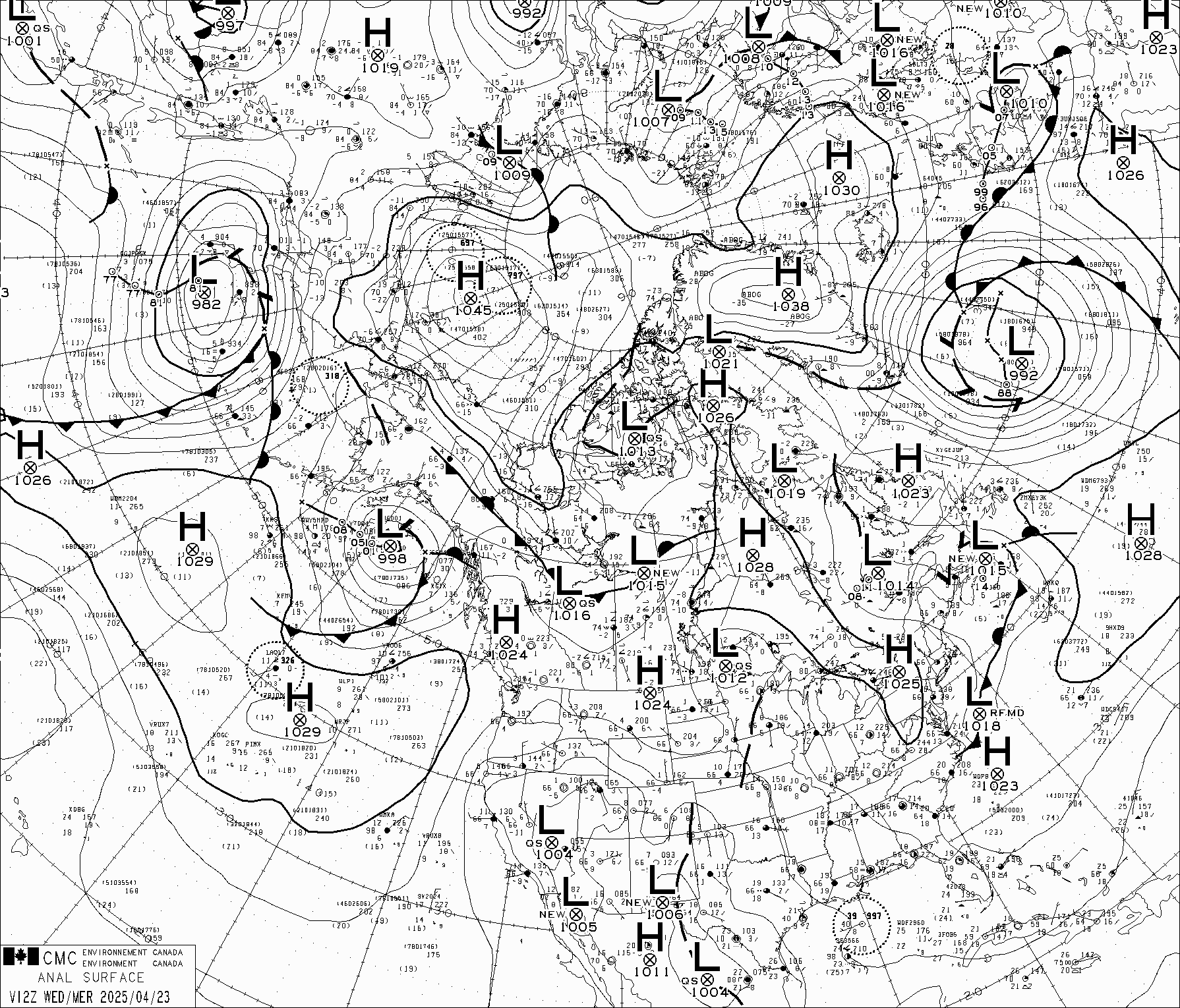
Surface Map
This map shows weather systems at ground level.
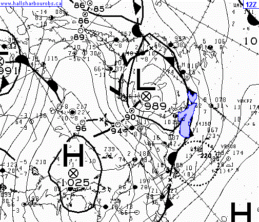
Updated: 2026-07-10 at 12:07 ADT Full maps: 00Z - 06Z - 12Z - 18Z from Environment Canada |
Upper Level Map
This map shows weather systems at about 30,000 feet.
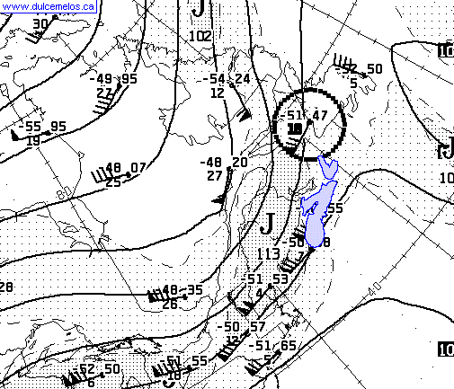
Updated: 2026-07-10 at 14:36 ADT Full map: 250 hPa from Environment Canada |
Infrared Satellite Photo
GOES East Infrared Image. Click image for latest update.
from Environment Canada
|
Radar MapEnvironment Canada RadarShows precipitation and lightning. EC no longer provides an image link. Use the text link above to access the animated radar map.
from Environment Canada Maine radar (AccuWeather) |
||
Other Image Links
| |||
Astronomical Forecast |
Lunar Phase 2026-07-10 16:55 ADT 25.73d, 15% | Upcoming
|
|||||||||
Forest Fire Danger
see also NS Fire Weather Forecast NS Fire Weather Forecast Map NS Burn Restrictions Map |
Tides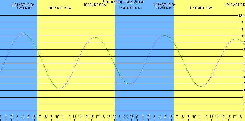

The harbour at Hall's Harbour |
Copyright © 2026 by Kathleen Walker
Last modified: 09-Jul-2026
